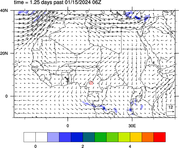
Here are forecasts and rain accumulations for a point near Kumbo, Cameroon at 6.26°N, 10.95°E.
Forecast for wind and precipitation
This animation shows the forecast of precipitation (color shading) and horizontal winds about 1.5 km above sea level. The precipitation is the accumulation over the previous 6-hour period, in millimeters (1 inch = 25 mm), and winds are measured in m/s (1 m/s = 2.2 miles per hour). This is from a single deterministic forecast.
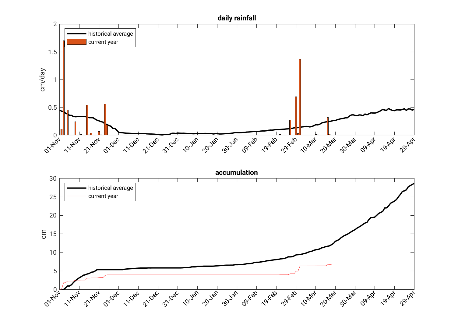
Seasonal rain accumulation
The below plots show the daily rainfall and the total seasonal accumulation of precipitation, compared to the historical average, for our point of interest (shown by the red star in the above map).
All forecast data is from the Global Ensemble Forecast System (GEFS) of the U.S. National Centers for Environmental Prediction (NCEP). All forecasts use an initial atmospheric state at the time indicated on the plot (note that 00Z is midnight Universal Coordinated Time, which is 1 am in central Africa or 8 pm the previous day in New York [EDT]).
Latest updates from the Famine Early Warning Systems Network
FEWS NET was created by USAID in 1985 to help with advance planning for possible humanitarian crises. They do not have staff in Cameroon, but monitor it from a neighboring country. Be sure to look at their latest updates on Cameroon, (always click through to “Read More” at the bottom), and also view their analyses of agriculture supply and price trends.