While the African monsoon that is most widely known lies north of the equator and takes place during the northern hemisphere’s summer, a monsoonal circulation does exist over the southern part of the continent during the southern hemisphere’s summer. The precipitation maximum during this season stretches from Angola on the west coast of southern Africa all the way to Madagascar.
Forecast for wind and precipitation
This animation shows the forecast of precipitation (color shading) and horizontal winds at 850 hPa, which is about 1.5 km above sea level. The precipitation is the accumulation over the previous 6-hour period, in millimeters (1 inch = 25 mm), and winds are measured in m/s (1 m/s = 2.2 miles per hour). This is from a single deterministic forecast. The red box outlines the region over which the total accumulation of rainfall for this season (shown below) is averaged.

All forecast data is from the Global Ensemble Forecast System (GEFS) of the U.S. National Centers for Environmental Prediction (NCEP). All forecasts use an initial atmospheric state at the time indicated on the plot (note that 00Z is midnight Universal Coordinated Time, which is 2 am in central Africa [e.g. Johannesburg] or 7 pm in New York [EDT]).
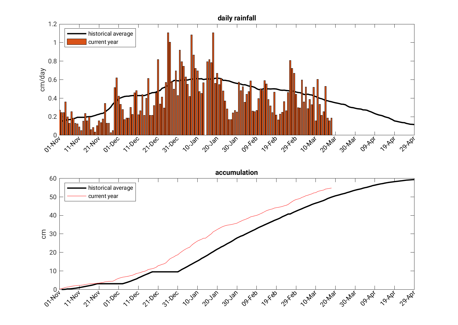
Seasonal accumulation
The below plots show the daily rainfall and the total seasonal accumulation of precipitation for southern Africa (averaged over the red box shown above), compared to the historical average.