Home » Posts tagged 'flooding'
Tag Archives: flooding
Monsoon rains induce flooding in Jakarta, Indonesia
by Nina Horstmann
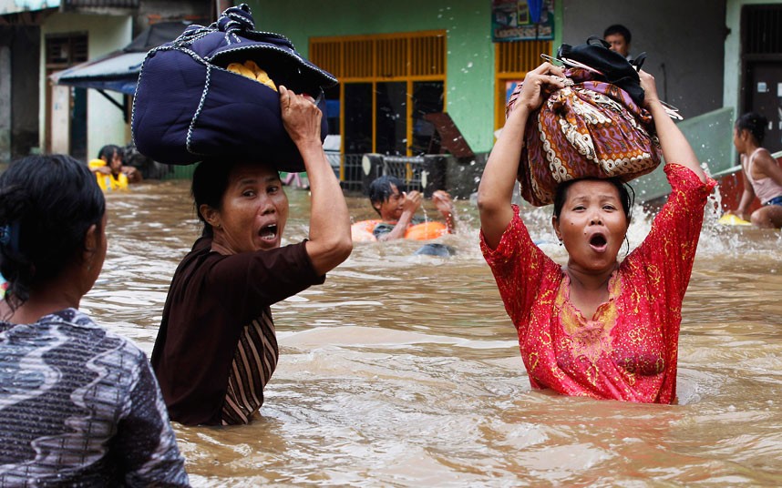
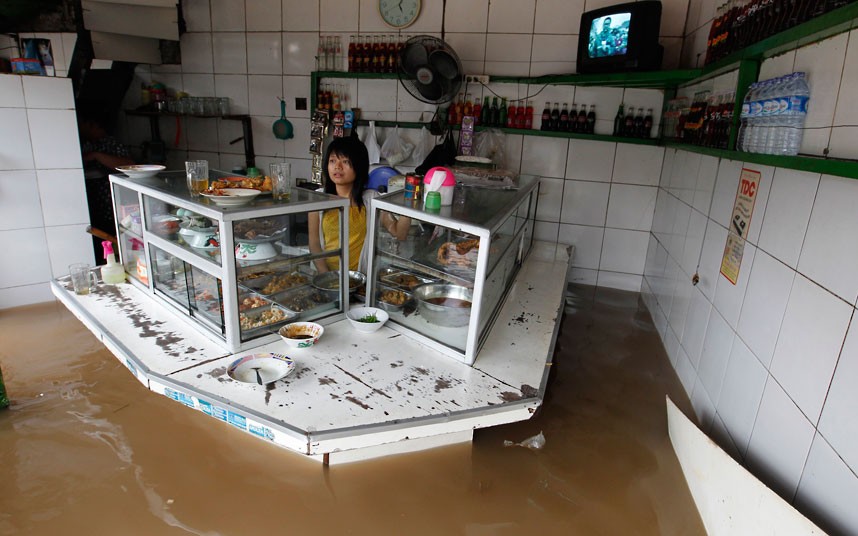
In early February, persistent rains triggered massive flooding in Jakarta, the capital of Indonesia, with floodwaters reaching up to 100 cm. Seasonal monsoon rains and the poor drainage of the low-lying capital city make flooding from late January to mid February an annual event. Other parts of Indonesia, such as the islands of Sumatra and Sulawesi, also experience seasonal flooding and mudslides, but these events are typically most severe in the capital. Around 240 square kilometers of central Jakarta lie below sea level, and flooding can become acute when heavy rain and high tides coincide.
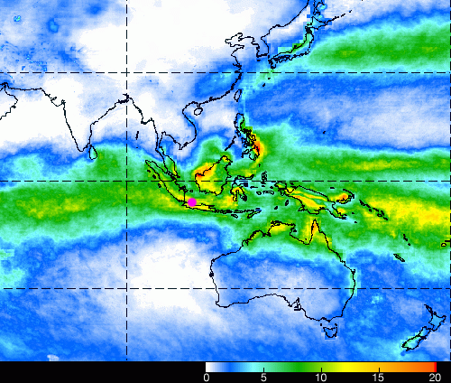
Indonesia experiences extreme variations in rainfall between its wet and dry seasons because of the seasonal shifts in winds that constitute monsoons. Jakarta lies about six degrees of latitude south of the equator, and so receives the most rain in January, when the warmest, wettest air rises just south of the equator in the summer hemisphere. In fact, the island of Java, which is home to Jakarta, is right in the center of the Indian Ocean’s intertropical convergence zone – the near-equatorial band of precipitation that stretches around the planet.
The annual nature of the monsoon and related flooding in Jakarta complicates disaster response. In contrast to abrupt events such as a typhoon or tsunami, annual flooding is anticipated and gradual. Because of its expectedness, annual flooding enters the realm of the ordinary and does not prompt swift action or response. However, the Indonesian government still has not created a comprehensive system for addressing massive flooding, which annually brings the city of Jakarta to a standstill. Yayat Supriatna, a public infrastructure analyst, commented in The Jakarta Post that, “The city administration has to run faster by repairing the poor drainage system to allow a smooth flow of rainwater to all rivers; and also the pump houses, so that floodwater can be pumped out to the sea rapidly.” Because of the dense population of the Jakarta metropolitan area (according to the Central Bureau of Statistics, approx. 28 million in 2010), these annual flooding events affect millions of citizens.
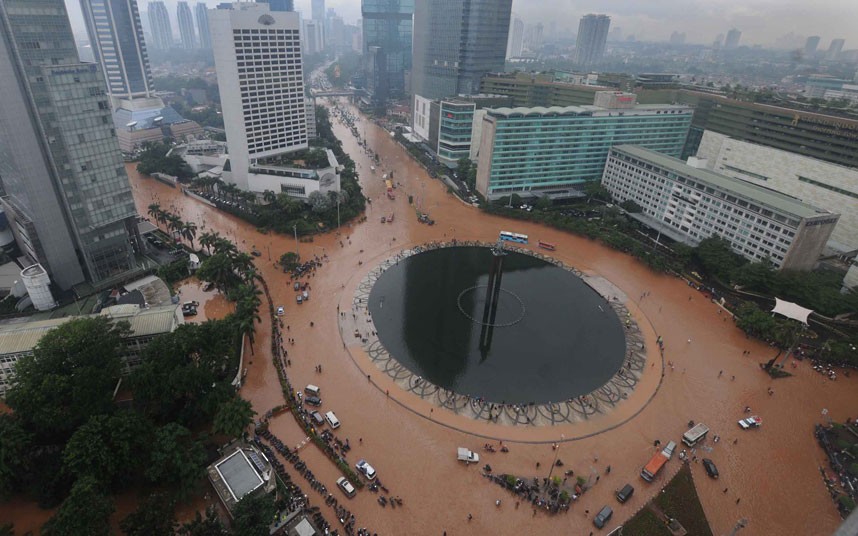
Yearly, flooding disrupts transit and business activity, displaces thousands of residents, creates economic damage, and results in dozens of fatalities. Importantly, because the imbalance between precipitation and surface evaporation is expected to increase as climate warms, flooding might worsen in future decades. In 2013, Jakarta experienced an extreme year; a river burst its banks and flooding engulfed the Central Business District, resulting in hundreds of millions of dollars in property damage. In 2007, the human impacts of annual flooding were particularly dire, when 80 people were killed and an additional 200,000 were displaced due to severe flooding.
In order to prepare citizens and inform them of the extent of seasonal flooding, the Indonesian government is turning to the Internet and social media to disseminate forecast information. On its website, the Indonesian Agency for Meteorology, Climatology, and Geophysics (BMKG) provides a daily weather forecast as well as a map displaying the flood potential for different parts of the city. Additionally, the Natural Disaster Mitigation Agency (BPBD) and the Traffic Management Center of the Jakarta Police Department are using Twitter to release regular information of flood conditions in the city. A new website, PetaJakarta.org, also draws on the Twitter platform, using crowdsourcing to aggregate and map flood-related tweets.
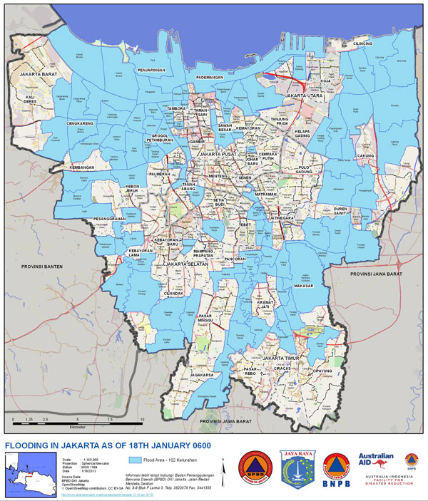
PetaJakarta is an initiative run by BPBD and the SMART Infrastructure Facility at the University of Wollongong in Australia. The project reported that on February 9, a day which experienced massive flooding, their map pulled in around 800 flood-related tweets per hour and more than 12,000 users logged onto their site that day. The PetaJakarta mapping initiative allows BPBD to receive real-time reports, expediting their response to emergencies, and enables citizens to monitor flooding and traffic levels in their neighborhoods. Social media and Internet resources offer exciting new opportunities to disseminate advance forecasts and real-time weather and traffic conditions. This model could perhaps be extrapolated to other megacities in the tropics that are affected by monsoons and flooding.