Home » Posts tagged 'drought'
Tag Archives: drought
El Niño and climate change cause drought in southern Africa
By Harland Dahl
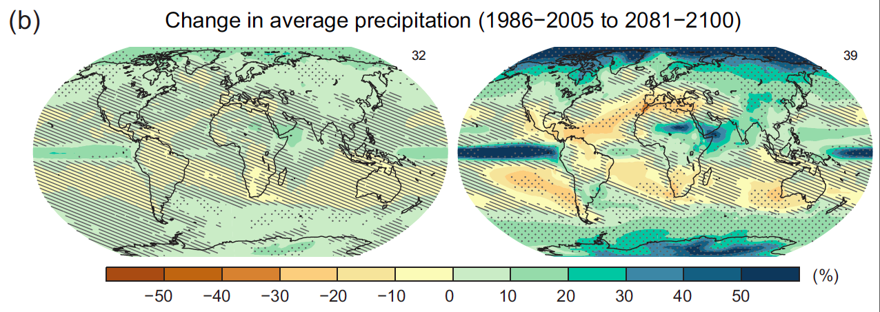
According to data collected from annual reports on rainfall in southeast Africa, mean summer rainfall has been steadily declining in the region over the past 200 years. It is suspected that this drying trend has been significantly influenced by climate change. Indeed, most climate models predict a reduction in rainfall over southern Africa in the next century, although there is less agreement amongst models for the northern parts of the continent. Today, we see strong year-to-year variability superimposed on these trends as African countries face both severe droughts and flooding.
Many African nations faced severe droughts this past summer, including Tanzania, Kenya, Ethiopia, and Somalia. Strong El Niño conditions are expected to bring some relief to these countries over the next few months, as El Niño is typically associated with enhanced rain over east-central Africa. Although heavy rains are expected to be beneficial in these areas, storms also have the potential to cause dangerous flooding, particularly in the Horn of Africa.
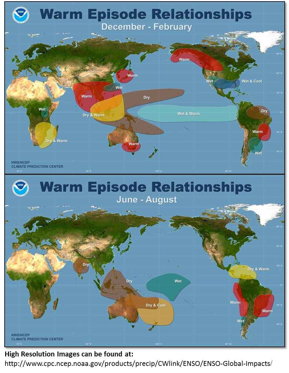
South Africa, by contrast, is typically drier than usual during El Niño. If this region receives less rain than usual, this would compound existing dryness: the 2014/2015 season was the third-driest South Africa had seen in eighty years. In recent weeks, South Africa has faced several heat waves, some affecting the country’s maize belt. In response to water shortages, the South African government has imposed water restrictions in certain cities, and urged livestock farmers to limit their herd sizes to preserve water supplies.
According to David Nash, University of Brighton College of Life, Health and Physical Sciences professor, this year’s El Niño weather pattern could bring risks of serious droughts in southern Africa. In an interview with The Argus newspaper, Nash explained, “The timing of droughts shows a strong relationship with El Niño events, particularly during the latter half of the 19th century. Drought events were particularly severe during the rainy season immediately following an El Niño event.”

Droughts like these could be extremely threatening to food security in many areas of southern Africa, where 29 million people are food insecure and low levels of rainfall could lead to the death of livestock and reduced grain and cereal yields. In the past, weather crises like these have led to significant increases in staple food prices across African countries. In 2011, for example, staple prices were 68% higher than the region’s five-year average as a result of drought conditions. According to the United Nations, the countries most affected by staple price inflation often include Somalia, Ethiopia, and Kenya.
Southern Africa is particularly susceptible to the effects of climate change. According to recent climate models and research, it is possible that temperatures in southern Africa will increase one and a half times more quickly than the global average temperature increase in coming years.
In response to these threats, the World Bank has invested $US16 billion in a plan to help African countries prepare for and respond to climate change and its effects. This plan aims to help African countries “highly vulnerable to climate shocks” prepare for changes in weather patterns that could affect anything from health to infrastructure to crop production. It also includes efforts to boost clean energy production and increase access to electricity.
Thailand drought leaves lasting effects, even as rainy season begins
By Harland Dahl
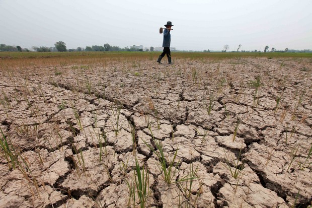
While some areas of Thailand currently face heavy monsoon rains, others suffer from the effects of a drought that began in November of 2014. This was the worst drought experienced by Thailand in over a decade.
The drought has had lasting negative effects on Thailand’s agricultural sector and has led to difficulties in rice farming, a crucial crop for Thai farmers and families. Thailand is the world’s largest rice exporter, with rice farming taking up 40% of Thai agricultural land and representing a significant portion of Thailand’s labor force and economy.
Other crops have been affected, as well, threatening the livelihood of many Thai citizens. Over half of Thailand’s working age population is supported by the agricultural sector.
In response to water shortages caused by the drought, the Thai government has asked farmers to delay rice production. Thai Minister of Agriculture and Cooperatives Petipong Pungbun Na Ayudhya explained, “The agriculture ministry and irrigation department have requested that farmers delay rice planting in the Chao Phraya area because the Chao Phraya area is a large rice growing area… and we need to organize the water that is being used.”
By delaying rice production, the government hopes to reduce nonessential water usage until monsoon rains bring relief from the drought. Thailand’s rainy season usually lasts from May to October, bringing an average of 2.4 meters of rain to Thailand’s southern regions, and 1.4 meters to the northern and central parts of the country.
Although Thailand’s rainy season had already begun, as of July 6th, 22 of the country’s 76 provinces were still facing drought conditions. The Thai Meteorological Department anticipates that this year’s rainy season will deliver mostly “near normal” rains. A report published by the department on June 26th predicts that the southwest monsoon will begin to travel north in July, bringing heavy to very heavy rains to Upper Thailand. Then, as is typical in the seasonal cycle, the rainfall maximum of the South Asian monsoon will shift southward in October towards Southern Thailand.
The Thai government is struggling to simultaneously provide relief from the drought, implement a water management plan to safeguard against future droughts, and prepare for threats presented by monsoon rains.
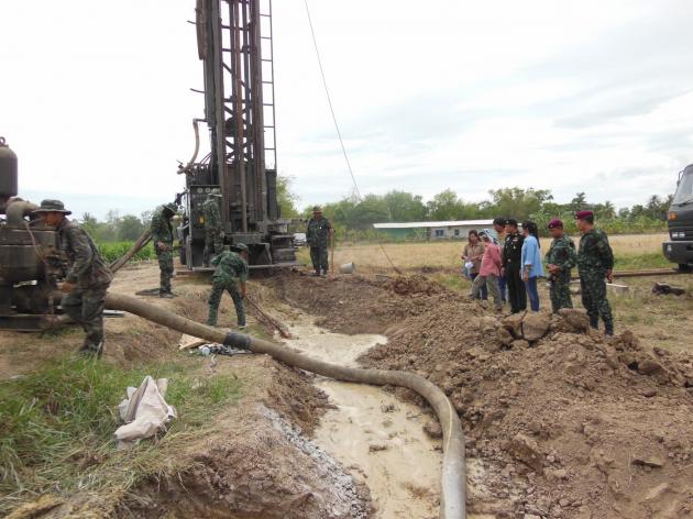
In response to the drought, the Thai government has implemented a system of daily water delivery to the most drought-affected areas using water trucks. Unfortunately, these efforts have often been insufficient to fulfill many communities’ water needs. The government has also used cloud seeding technology to create artificial rain to aid Thai farmers who depend on rice farming for their livelihood and keep rice production levels up.
Thailand has also announced a plan to invest $7.5 billion in water management projects in the coming years. These include a 10-year water management plan, a replacement for the less successful management plan of a previous regime.
The start of the rainy season has already led to flooding and mudslides in Bangkok, as well as in Thailand’s Central Plans. To prepare for future rains, the government has begun to dig waterways to contain rainwater and use social media to warn citizens of flooding risks.
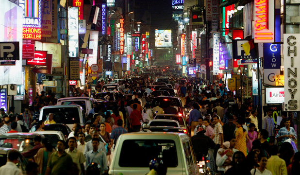
Monsoon affects economy, health in India
By Harland Dahl
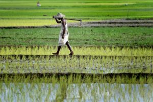
India’s monsoon hit the Southern Indian state of Kerala on Friday, June 5th, four days later than expected. With monsoon rains comes relief from India’s stifling heat wave, which began in May.
The Indian Institute of Tropical Meteorology predicts that the monsoon will spread across most of India by the end of June. Rains are expected to reach the country’s West coast by June 17th and central India by June 25th. The India Meteorological Department predicts that the monsoon will be weaker than usual, bringing less than 90% of typical monsoon rainfall.
It is estimated that crop planting in India has gone down by 9% since last year. This is due to weak monsoon rains, which not only lead to low crop production, but to high food prices. The crops most affected are grains and cotton.
In response, the Indian government has taken several steps to boost agricultural production. The India Meteorological Department has begun to send mobile weather alerts to farmers, and public officials have been promoting the cultivation of more drought-resistant crops.
Minister of Agriculture Eknath Khadse explained, “Growing vegetables and fruits would be our priority. This will give farmers something for daily survival, without too much investment, along with the main crops ahead of the kharif season.”
The agricultural sector employs more Indian citizens than any other sector of the economy. This means that a below-average monsoon could have a significant effect on the Indian economy, as a whole. The ICICI Bank of India estimates that weak rains will cause a drop in India’s GDP growth for this fiscal year, from the originally estimated growth rate of 7.8% to 7.3%.
But even during a relatively dry year, monsoon rains have the potential to negatively impact other sectors of the Indian economy, as well. Heavy rains put crucial infrastructure at risk throughout India, and are particularly threatening to burgeoning industrial cities such as Bangalore, home to 30% of India’s startup companies.
With heavy rains come blackouts and losses in internet connectivity. While larger corporations can afford more reliable internet connections, smaller companies often depend on unreliable nationwide internet service providers or local cable networks.
Weakened infrastructure has also lead to sanitation problems in many parts of India, particularly in poorer parts of the country’s largest cities. Although overall water contamination levels have gone down in the past decade, contamination usually rises significantly during monsoon season.
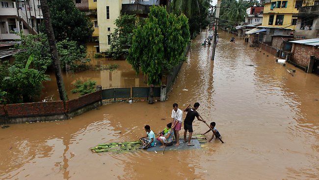
Rising underground water levels during the monsoon season affect outdated underground sewages systems and leaking pipes, leading to abnormally high levels of E Coli and other bacteria. These bacteria cause diarrheal disease and various water-borne illnesses.
Vector-borne diseases such as malaria and dengue are also particularly prominent during monsoon season. To avoid exposure to contaminants, Indians are encouraged by health officials to take precautionary measures such as boiling all drinking water and only eating foods stored inside.
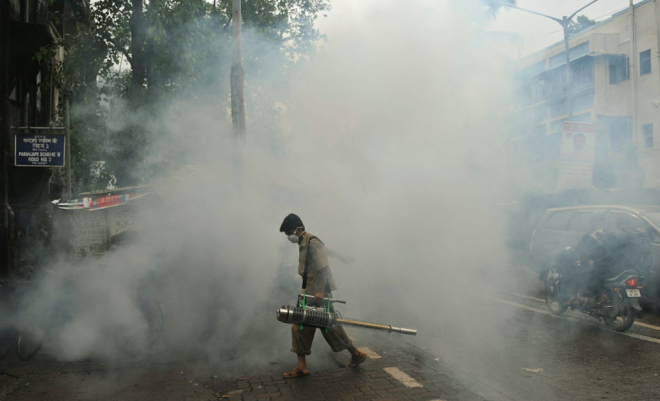
Fumigation efforts are also ramped up during monsoon season, which is also breeding season for mosquitos. Those most affected by both vector and water-borne diseases include children and the elderly, often due to time spent outside or an inability to fend off infection.
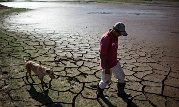
Drought in São Paulo: Causes and Effects
By Julia Rothchild
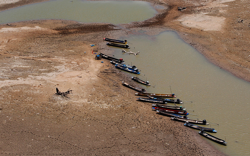
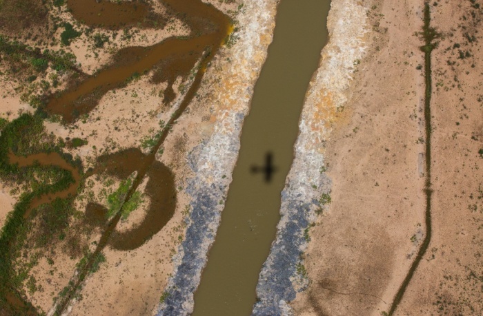
About a year ago in the Bolivian Amazon, floodwaters washed away the homes and property of 150,000 people. But right now, just 1500 miles away, inhabitants of São Paulo are experiencing the worst drought in decades. Last week, residents drilled through their own basement floors, hoping to find groundwater available for drinking. The city’s main water utility has lowered the water pressure in pipes so that people use less.

The causes of these two recent South American weather extremes may be connected. Some meteorologists have argued that the flood and the drought could be explained by a meteorological phenomenon in which the usual migration of high- and low-pressure systems is disrupted. This is called “atmospheric blocking,” and usually happens when a high-pressure system stops moving across the globe and hovers in the mid-latitudes. Because it is stuck in one place, the system blocks the normal travel of weather systems from west to east.
The floods may have been caused when winds, forced to rotate around a stationary system, brought moisture-laden air into the Bolivian Amazon. The same process may have led to the drought in São Paulo, as winds carrying precipitation haven’t been able to reach the area. That means there’s almost no water in the air over that part of Brazil, and therefore little rain.
The map below shows how much atmospheric pressure has deviated from the norm over the past six months. The culprit – a high-pressure area shaded in red – hovers just southeast of Brazil. This “block” of air drives normal wind patterns into a meteorological traffic jam, in which some air becomes stuck where it shouldn’t be. Wind flowing counter-clockwise skirts around the edges of this high, and brings dry air from outside the tropics into South America.
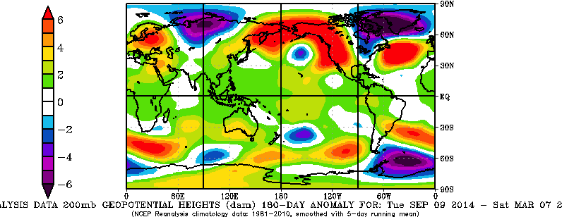
(As an aside, it is interesting to note that the dark purple shading over northeastern Canada indicates that there is a low-pressure system there. The very cold winter in the eastern U.S. this year is associated with this northern hemisphere low. Air flows counter-clockwise around this area, bringing cold arctic air into central and eastern North America.)
Scientists attribute the recent Bolivian flood and Brazilian drought to a single event of atmospheric blocking, as opposed to the wider trend of man-made climate change. But some think that what is considered an anomaly now could become commonplace if the world’s temperatures keep rising.
The current São Paulo drought is ravaging the city. Nine million people rely on the Cantareira reservoir system, which is currently only 5% full. Another three million usually receive water from the Alto Tietê reservoir network, which is less than 15% full. The government has proposed rationing water, so that every week residents of São Paulo have two days with water and five days without.
Inhabitants of São Paulo have responded to governmental water restrictions by hoarding the water they can find in containers. These buckets and watering cans are often left open outside, and as such, they have become ideal places for mosquitoes to breed. In a seemingly paradoxical twist, the drought has created a haven for mosquitoes that thrive in wet conditions.
This is a huge problem because many mosquitoes in the region carry dengue fever, which causes high fever and muscle convulsions. The incidence of disease is up 163% from last year. In some parts of the São Paulo state, the figure is worse, and officials are calling this an epidemic.
The Brazilian water crisis is a result of uncontrollable weather patterns, but is exacerbated by a failure of resource management. Environmental advocates have attempted to put an end to practices that pollute areas of water production. But according to some, the Brazilian government heavily supports efforts to expand exports of soya, beef, and pig iron and focuses less on environmental issues. These industries are the cause of much of the deforestation and greenhouse gas emission in the country, which may lead to even worse droughts in the future.
How monsoons drive life in the Western Ghats
By Julia Rothchild
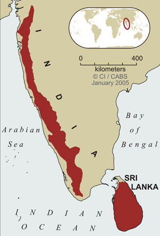
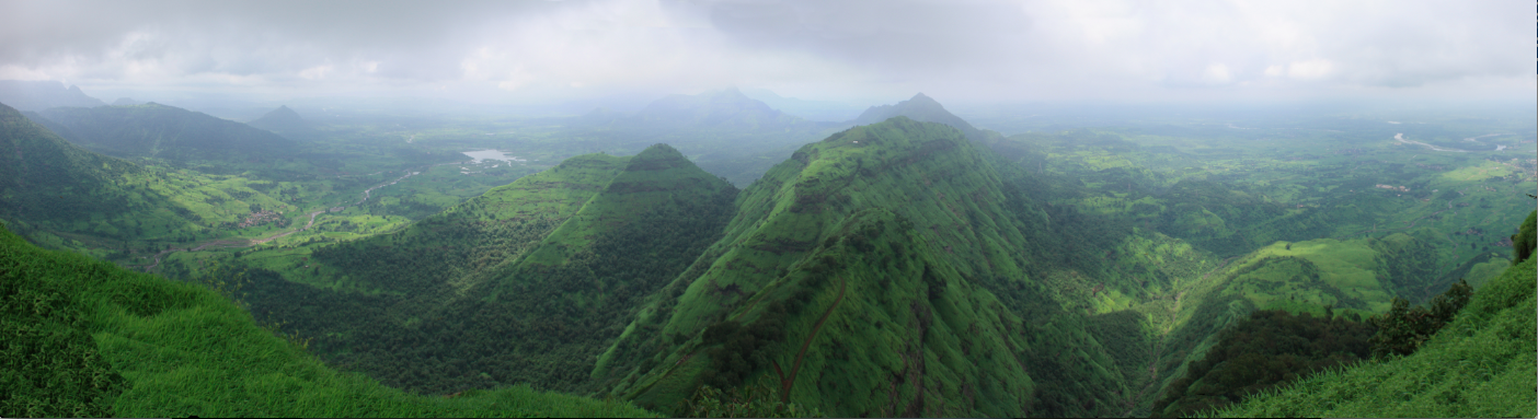
In the mountains of southern India, the grass really is greener on the other side. The Western Ghats, a mountain range that runs for 1,600 kilometers along the western coast, support much more plant and animal life on one side than the other. The ecological contrast is due in part to the heavy rains that sweep over the country for several months every year.
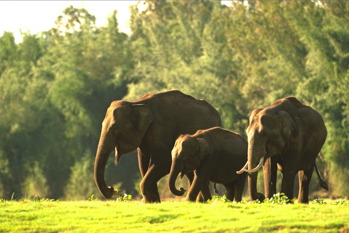
During monsoon season, the side of the Western Ghats mountain range that faces the Arabian Sea is covered in dense deciduous and evergreen forests. The earth blooms with thousands of species of flowering plants. The macaque, Asian elephant, purple frog, and crimson-backed sunbird all find a home among the verdure. The rivers and lakes are full.
The other side of the Western Ghats – the side that faces most of the Indian peninsula – is parched by comparison. Brown savannas cover the earth. The diversity of flora and fauna is more limited.
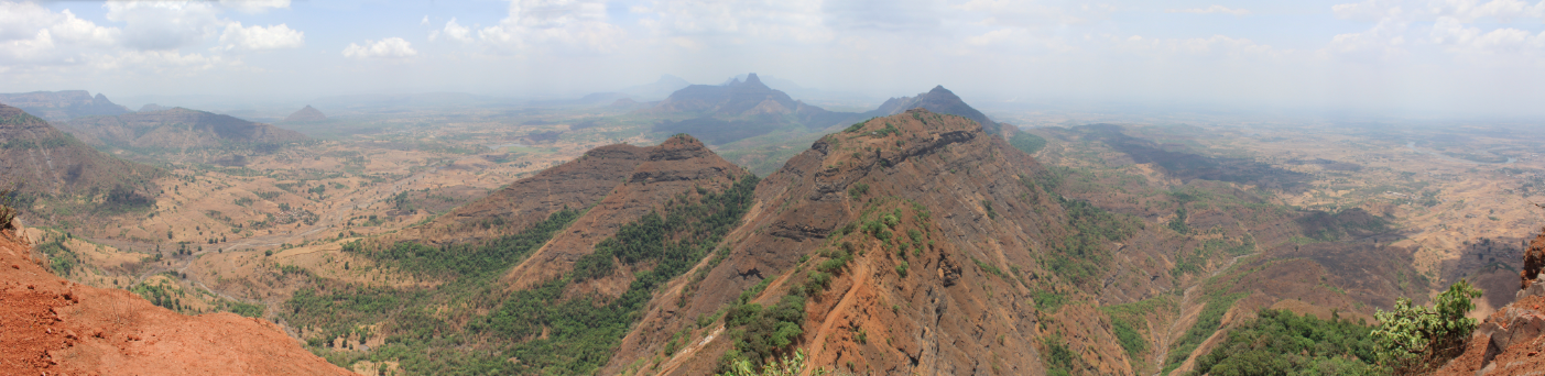
This natural disparity – more pronounced in some areas than in others – arises because of the way monsoons make their way towards the mainland at the end of every spring. Air near Earth’s surface flows northward from the winter hemisphere toward the Asian land mass that is heated by the summer sun. The Coriolis force turns this air to the right to become the low-level “monsoon westerlies” – eastward winds that constitute the lower branch of the monsoon circulation. These winds are laden with moisture, and travel across the Arabian Sea towards India. About 40 kilometers inland, the air is confronted with the massive chain of mountains, which act as a tall barricade. In order to cross the mountain range, like any good hiker, the monsoon air must trudge up and over. While the air climbs the slopes, much of its moisture falls as rain. When it reaches the other side, the air has been depleted of moisture, which means the climate is more arid east of the peaks.
Due in large part to the huge amount of rainfall on their windward side, the Ghats are one of the world’s eight “hottest hotspots” of biological diversity. Around 5,000 species of vascular plants alone grow there, as do hundreds of species of mammals, reptiles, birds, and amphibians. A large number of these species are endemic to the Ghats: they are found nowhere else in the world. The monsoons therefore nourish an exceptionally vibrant pocket of life. They enable a hotspot of biodiversity, saturated with water, to thrive.

But when the clouds are less generous, both on the drier side of the mountains and during the dry winter months, both wildlife and human life suffer. Drier air means fewer crops and, depending on the area, perhaps less business or more hunger.
Within the past month, it has been reported that farmers in the state of Maharashtra, of which Mumbai is the capitol, are suffering severely from a drought. Sixty percent of villages are currently facing “drought-like conditions,” and the state and Central government are attempting to find relief and aid money. This is the fourth drought in the state since 2008, and agricultural production in the area may be cut in half.
Is there a way to help farmers in areas prone to droughts? To predict anomalies in the Western Ghats, modeling monsoon behavior is critical. Current models are imperfect because of the number and complexity of factors involved. These factors include the starting temperatures of sea air and land air, the contour of the mountains, the size and depth of clouds, and the microscopic interactions between water droplets in the air. The enormous range of variables gives us some idea of the vast challenge climate scientists face when attempting to predict the outcome of the upcoming monsoon season in southern India. As research finds more effective methods to model each of these processes, we hope that predictions of how monsoon air behaves in any given season will improve, and with them the lives of people living in the shadow of the Western Ghats.
 Monsoon news from Google
- Stronger monsoon winds bringing more rainfall to arid regions of north-west India: Southampton varsity study - BusinessLine
- 2024 monsoon broke rainfall, temperature records, PMD says - Aaj News
- Monsoon tips for Women - The Hans India
- More cruise ships dock in Singapore than Hong Kong in July-August during monsoon season, Kai Tak underuse cited - Dimsum Daily
- PMD releases detailed report on 2024 monsoon season - The Nation
- As monsoon disease risks abound, TN health experts urge care - DTNEXT